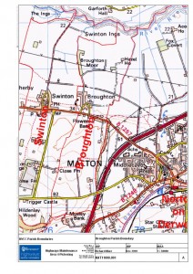
Broughton Parish Boundary from map supplied by NYCC Highways
The red line is the boundary of the Parish which extends from Swinton Ings in the north down to Musley Bank in the south.
Clicking on the map opens another page. Click on the map again and you will see a much larger version.
Speak Your Mind